Water from the most important ley line in the UK.
Drawn from a single underground source between Glastonbury Tor and Burrow Mump, where the Michael & Mary Line runs through the Somerset Levels. Filtered through rare Tufa limestone, a geological wonder found in only a few places in the world. Independently tested for two years, bottled at source and delivered in returnable glass.
Get the water right, and everything else falls into place.
Tufa-filtered spring water, shaped by stone, not a factory.
This water isn't made. It's the end of a journey that began as rain on the hills and took years to complete, slowly, underground, through ancient rock.
Rain on the hills
Rainfall lands on the high ground above the catchment and begins to sink, naturally slightly acidic, ready to take on the character of the rock below.
Years through the Tufa
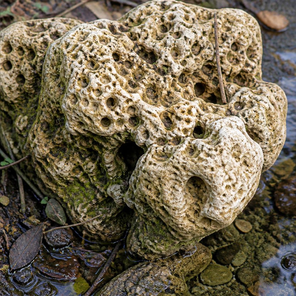
It percolates down through Tufa, a pitted, sponge-like limestone formed over decades from calcified mosses, twigs, leaves and snail shells. Slow contact with this rare rock is what shapes the water.
Shaped by the stone
As it travels, the Tufa gives the water its signature calcium character and holds it in perfect equilibrium, a naturally pH-neutral, sweeter, smoother water very few geologies can produce.
Rises as a spring
It returns to the surface as a single, named source, the same water people have drawn from this land for generations. Bottled here, at source, the moment it rises.
pH 7, high calcium, low sodium: what two years of testing tells us.
Every figure here comes from UKAS-accredited laboratory analysis of this exact source. Drop in your verified numbers, these are the claims your own data stands behind.
Why Tufa water is different
Nothing is added and nothing taken away. As rain passes through the Tufa of the Mendip Hills, it picks up a perfect combination of minerals, arriving at a pH of 7, high in calcium, low in sodium. That natural equilibrium is the reason our water tastes noticeably sweeter and smoother, and a fingerprint very few sources in the world can claim.
A geological marvel.
On a geological scale, Tufa is a young rock. Its pitted, sponge-like appearance is the direct result of its formation, calcified over many decades from mosses, twigs, leaves and snail shells. It is found in only a few places in the world and is quite rare in the UK. Thanks to its unique properties, our water retains the essence of calcium, giving it a naturally sweeter, smoother taste.
Between the two hills that made the line.
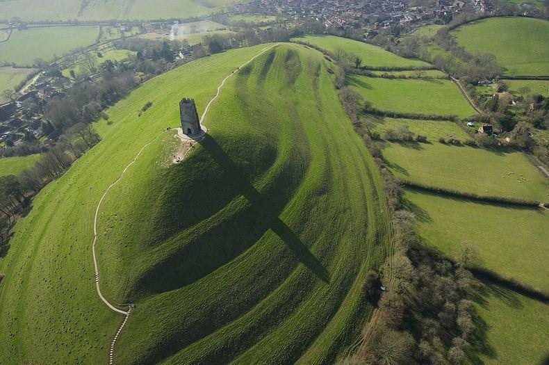
Our land at TA10, in Langport, sits in the heart of Britain's most famous ley line, and not just anywhere along it. It lies between the two Somerset hills that gave the line its name: Burrow Mump roughly five miles west, Glastonbury Tor about ten miles north-east.
The Michael & Mary Line
Britain's best-known alignment, roughly 350km from the far west of Cornwall to the Norfolk coast, traced through Lyng, Othery, Burrow Mump, Glastonbury Tor and Avebury on its way east.
Where it began
In 1969 John Michell first defined the line in The View Over Atlantis from the alignment of two Somerset hills, Glastonbury Tor and Burrow Mump, both crowned with ruined churches dedicated to St Michael. Our land lies between them.
The dragon path
Later dowsed by Hamish Miller & Paul Broadhurst in The Sun and the Serpent (1989) as twin "Michael" and "Mary" currents, the route is now marked on the National Trust plinth atop Glastonbury Tor as the dragon path.
Glastonbury Tor · the eastern anchor
Historic England lists St Michael's Church, monastic remains and settlement remains on the Tor as a scheduled monument. The National Trust describes it as a spiritual magnet for Pagans and Christians over centuries, many of the tales layered, blended and embellished through time.
Burrow Mump · the western anchor
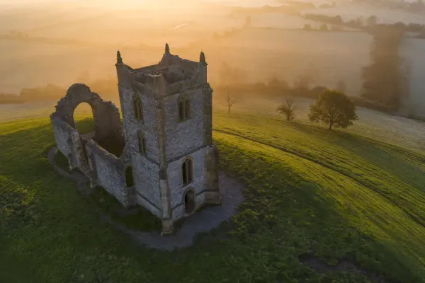
A solitary hillock rising out of the southern Somerset Levels, about ten miles south-west of Glastonbury Tor. The National Trust heritage record traces use across many periods, Saxon lookout, Norman castle, medieval chapel, with the earliest reference to the church on its summit recorded by William of Worcester in 1480 as "Myghell-borough." A 1548 chantry list names it "The Free Chapel of St Michael."
We share this as the heritage of the place, the folklore, pilgrimage and earth-mystery tradition written into this landscape, not as a claim about the water. Mainstream archaeology treats the Michael Line as folklore rather than physics, and we're glad to: legend doesn't need defending, and the water's qualities stand on their own in the lab results above. What's true is the geography, our land lies in the heart of the Michael Line, between the two Somerset hills that first defined it.
Rare Tufa spring water you can't bottle anywhere else.
A clean, testable, distinctive source is uncommon, and an unclaimed one in its own region is rarer still.
The area's own water
As far as our research shows, the first water sourced and bottled in this corner of Somerset.
A responsibly small yield
A single spring has a finite, sustainable flow. We cap membership to protect it, not to manufacture scarcity.
Founding members only
When this source reaches 1,000, it closes. Your place is one of a fixed number, for as long as you hold it.
Read exactly what you're drinking.
TESTED
The water quality dossier
The complete laboratory analysis for this source, chemical, microbiological and mineral profile. No claim here that the results don't back.
Found your source?
Hold one of the 1,000 founding places at The Mendip Source. Free today, you'll confirm when we open on 1 August.
Tufa spring water, answered.
The questions people ask most about the Mendip Source, its geology and its mineral profile.
What is Tufa rock and why is it rare?
Tufa is a young, porous limestone formed over decades from calcified mosses, twigs, leaves and snail shells. It is found in only a few places in the world and is quite rare in the UK, which makes a spring rising through it geologically unusual.
Where does Mendip Source water come from?
The Mendip Source rises from a single named underground spring in the Mendip Hills of Somerset, in the heart of the Michael and Mary ley line between Glastonbury Tor and Burrow Mump. It is bottled at source and delivered in returnable glass.
What is the pH of Mendip Source spring water?
Independent UKAS-accredited testing shows the water leaves the Tufa at pH 7, in perfect natural equilibrium: neither acidic nor alkaline.
Is Mendip Source high in calcium and low in sodium?
Yes. The Tufa filtration gives the water one of the highest natural calcium levels of any UK mineral water while keeping sodium very low, a mineral profile associated with bone and cardiovascular health.
How does Tufa change the taste of the water?
Because the Tufa holds calcium in equilibrium and nothing is added or removed, the water arrives noticeably sweeter and smoother than typical hard limestone waters.
Why does the Mendip Source only accept 1,000 founding members?
A single spring has a finite, sustainable flow. Membership is capped at 1,000 founding members to protect the source rather than manufacture scarcity.